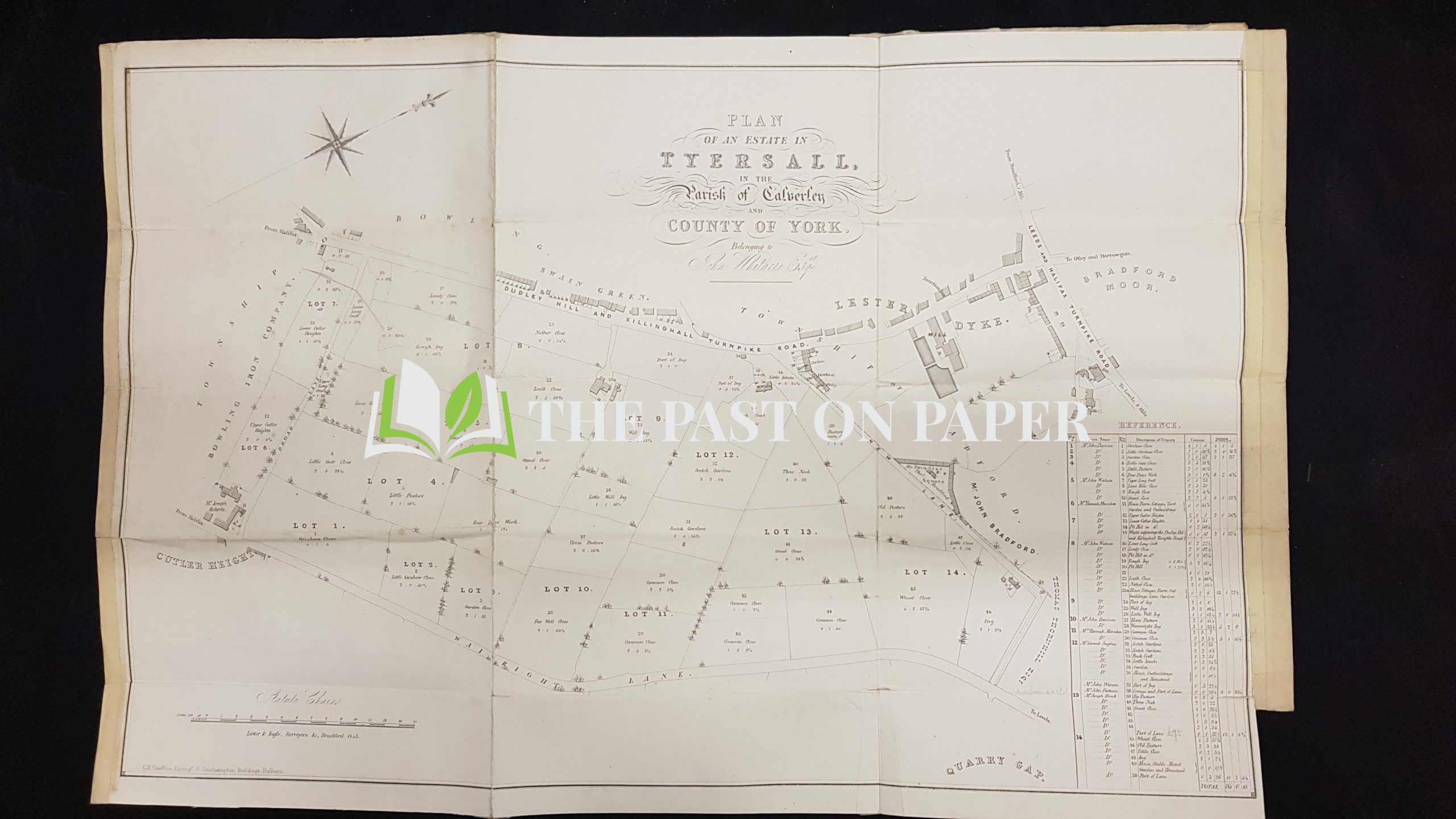
Estate Map and Sale Particulars and relating to Tyersal near Bradford,1843
Additional information
People associated with this item
Loading History...
A fascinating estate map and accompanying sales particulars for the sale of an estate in Tyersal ("Tyersall") near Calverley and Bradford dated 21st June 1843.
Folded four ways to fit a foolscap envelope and printed on heavy paper,the particulars unfold to a map measuring approx. 63cm x 43cm. The map divides the land into named parcels and identifies the occupier of each lot too. The parcels of land have names such as "Lovely Close", "Rough Ing", "Girshaw Close", "Wheat Close", "Four days Work" etc. Also clearly marked on the map is the Turnpike Roads to Leeds and Halifax, and Dudley Hill and Killinghall. Other features clearly shown on the map include The Mill, Junction Inn and White Bear Inn
The sale was carried out at The house of Mr John Davison, The Royal Engineer Inn, Dudley-Hill near Bradford
Tell us what you think
Can you add further information about this item? Are there errors in our transcription? Did this belong to an ancestor of yours? We would love to know what you know about this item! Add your comments below.
0 Comments